 click here for post script file (.pdf) | |||
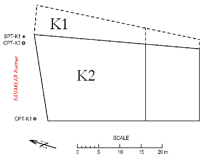
| Location: Kavaklar Avenue, Tigcilar District, Adapazari. | |||
| GPS Coordinates: 40.7775°N 30.4034°E | |||
(m) |
(click on photos for higher resolution images) | ||
click here for CPT log (.pdf) click here for CPT data file (.csv) |
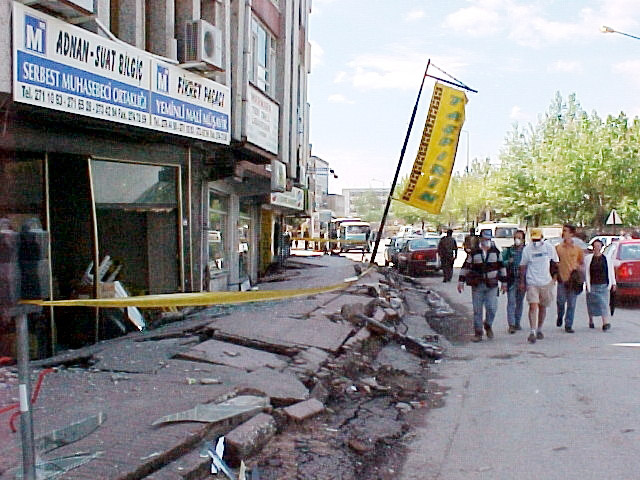 Bulging of soil along Kavaklar avenue (Photo by Jonathan D. Bray) | ||
click here for CPT log (.pdf) click here for CPT data file (.csv) |
 View of the North side of building K2 (Photo by Rodolfo B. Sancio) | ||
click here for boring log (.pdf) |
with SPT |
 View of the Northwestern corner of building K2 (Photo by Rodolfo B. Sancio) | |
click here to download all CPT data files (.zip) click here to download all SPT data files in .pdf and .lpt format (.zip) .lpt can be viewed with the FREE Rockware LogView click here to download the setup file | |||