(CLICK ON IMAGE FOR BETTER QUALITY) | |||
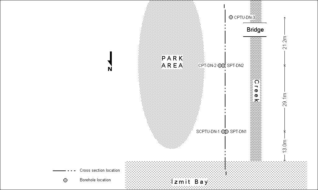 Plan view by: K. Ö. Çetin and M. T. Yilmaz 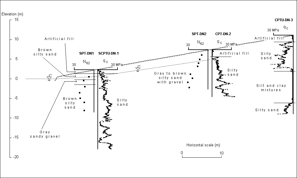 Cross Section by: K. Ö. Çetin and M. T. Yilmaz | |||
| Location: Degirmendere Nose, Degirmendere. | |||
| GPS Coordinates: 40.7219°N 29.7820°E | |||
(m) |
(click on photos for higher resolution images) | ||
click here for CPT log (.pdf) click here for CPT data file (.csv) |
 A view of the seismically-induced subsidence at Degirmendere Nose (Photo by Jonathan D. Bray) | ||
click here for CPT log (.pdf) click here for CPT data file (.csv) |
|||
click here for CPT log (.pdf) click here for CPT data file (.csv) |
8.48 | ||
click here for boring log (.pdf) |
with SPT |
 A view of the barge trying to recover bodies after the collapse of the Municipality Hotel (Photo by R. B. Seed) | |
click here for boring log (.pdf) |
with SPT |
||
click here for shear wave velocity profile (.pdf) | |||
click here to download all CPT data files (.zip) click here to download all SPT data files in .pdf and .lpt format (.zip) .lpt can be viewed with the FREE Rockware LogView click here to download the setup file | |||