(CLICK ON IMAGE FOR BETTER QUALITY) | |||
 Plan View and location of exploration points 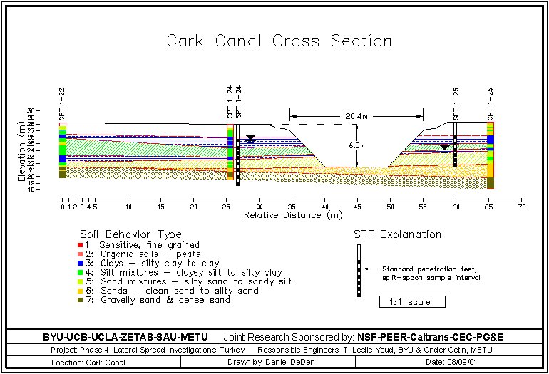 Generalized Cross Section | |||
| Location: Çark Canal, Adapazari. | |||
| GPS Coordinates: 40.7763°N 30.3830°E | |||
(m) |
(click on photos for higher resolution images) | ||
click here for CPT log (.pdf) click here for CPT data file (.csv) |
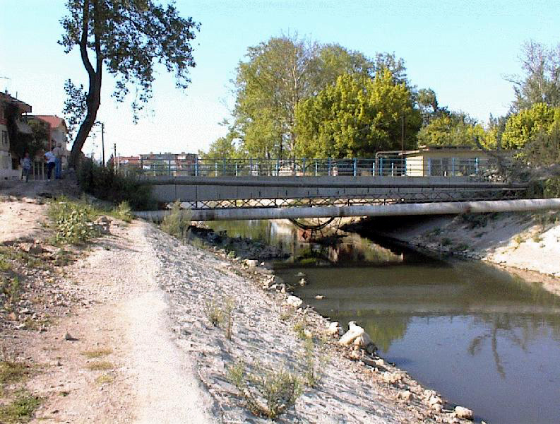
A south to north view of the Çark bridge from the west bank (Photo by Brady Cox) | ||
click here for CPT log (.pdf) click here for CPT data file (.csv) |
|||
click here for CPT log (.pdf) click here for CPT data file (.csv) |
|||
click here for CPT log (.pdf) click here for CPT data file (.csv) |
8.15 | 
A north to south view of the canalized river (Photo by Brady Cox) | |
click here for CPT log (.pdf) click here for CPT data file (.csv) |
|||
click here for boring log (.pdf) |
with SPT |
||
click here for boring log (.pdf) |
with SPT |
||
| SASW click here for shear wave velocity profile (.pdf) | |||
click here to download all CPT data files (.zip) click here to download all SPT logs in .pdf and .lpt format (.zip) .lpt can be viewed with the FREE Rockware LogView click here to download the setup file | |||