 click here for post script file (.pdf) | |||
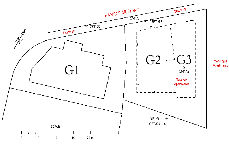
| Location: Hasircilar Avenue, Yenigün District, Adapazari. | |||
| GPS Coordinates: 40.77450°N 30.40896°E | |||
(m) |
(click on photos for higher resolution images) | ||
click here for CPT log (.pdf) click here for CPT data file (.csv) click here for shear wave velocity profile (.pdf) |
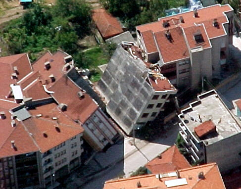 Aerial view of the overturned G2 and G3 buildings (Photo courtesy of Ellen Rathje)
| ||
click here for CPT log (.pdf) click here for CPT data file (.csv) |
|||
click here for CPT log (.pdf) click here for CPT data file (.csv) |
11.37 | ||
click here for CPT log (.pdf) click here for CPT data file (.csv) |
 View of the location where buildings G2 and G3 were previous to the Kocaeli earthquake. Building G1 is seen in the background. (Photo by Rodolfo B. Sancio)
| ||
click here for boring log (.pdf) |
with SPT |
||
click here for boring log (.pdf) |
with SPT |
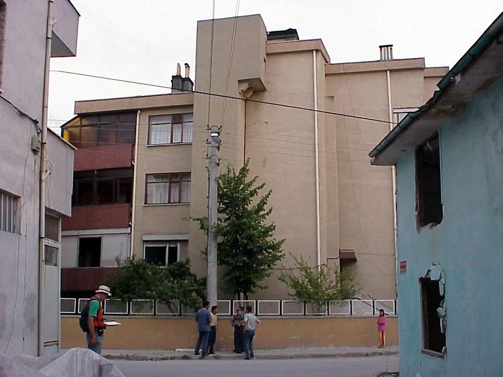 Northern view of building G1 (Photo by Jonathan Stewart)
| |
click here for boring log (.pdf) |
with SPT |
||
click here to download all CPT data files (.zip) click here to download all SPT logs in .pdf and .lpt format(.zip) .lpt can be viewed with the FREE Rockware LogView click here to download the setup file | |||
click here for shear wave velocity profile (.pdf) | |||