
Some Observations of Geotechnical Aspects of the February 28, 2001, Nisqually Earthquake in Olympia, South Seattle, and Tacoma, Washington
Natural Slope Stability
Inland Landsldies
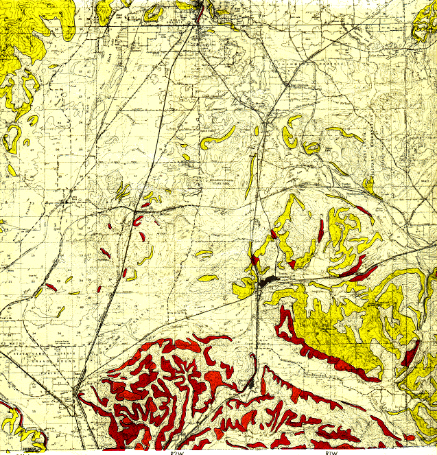
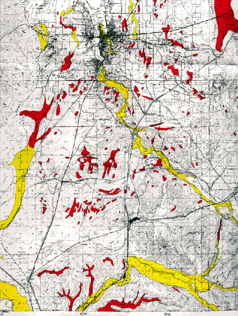
An aerial survey of a 35 square mile area south of Tumwater was carried out as part of the earthquake investigation. The trace outlined below on the overview map shows the pathway flown through the area. The objective of the aerial survey was to investigate areas of high slope stability and ground settlements according to published hazard maps (Artim, 1976). Areas that are susceptible to ground settlement are identified on the overview map below as red polygons. Areas that could be subject to ground settlement under seismic loading were mapped based on factors such as thickness and type of earth materials, consolidation test and bearing capacity data. Slopes that are potentially unstable are identified on the overview map below as purple polygons. These stability of these slopes is dependent on type of earth materials, ground shaking, water, types of vegetation and steepness of the slopes.
The overall conclusion of the survey was that little damage occured in the area flown south of Tumwater, despite the high ground motions recorded in this area. Due to the numerous open pit mines in the area we were able to observe the behavior of man-made slopes and did not identify any landslides. According to a brief interview with a shift supervisor at Centralia Mine, no landslide damages had been reported on the mine property. Several possible landslides and ground failure locations were identified during this survey which are documented below. Further ground verification of the exact cause of these failures was not possible due to time and access constraints.
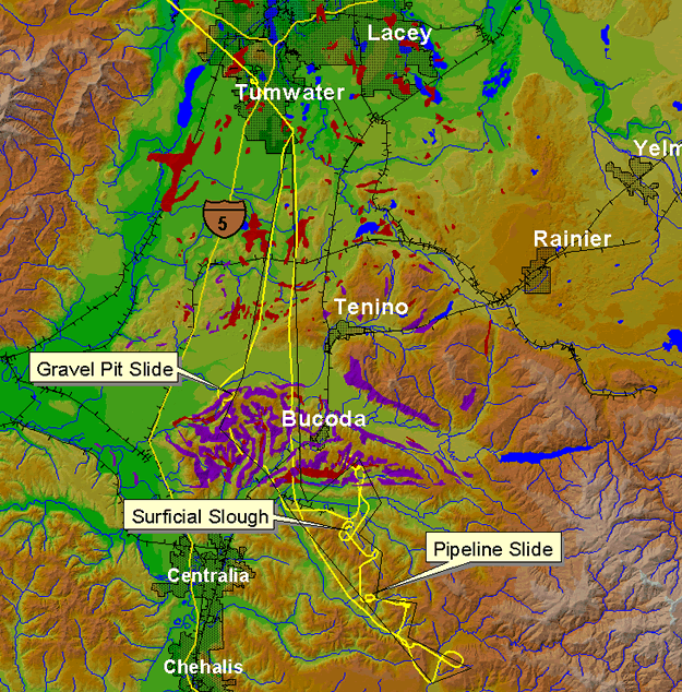
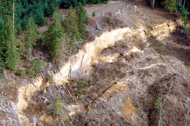
Gravel Pit Slide
Slide is located 0.5 mile south of Highway 99 just before Sunnydale. This is an older slide which may have been reactivated during the Nisqually earthquake as can be evidenced by the fresh scarps and cracks. The younger smaller trees have most likely been planted to help retain this slope. We were not able to identify any recent talus deposits however.
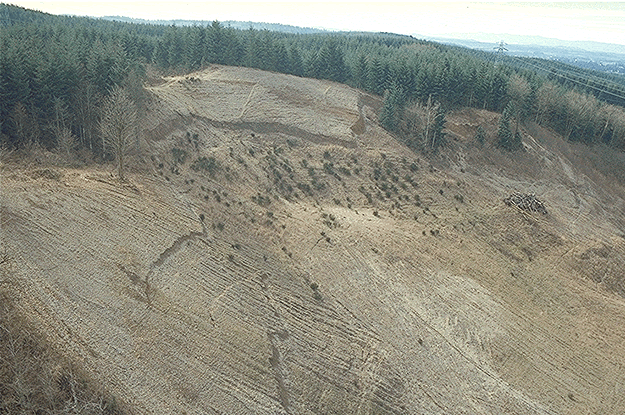
(N46 49 34.6 W122 56 49.3, 3/4/01)
Surficial Slough
Shallow planar surficial slough on the roadside about 900 feet east of Dam Number Three. The height of the slide is approximately 8 meters.
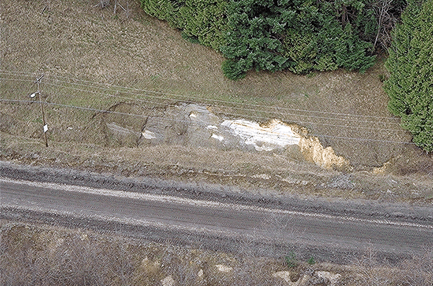
(N46 44 35.1 W122 50 52.0, 3/4/01)
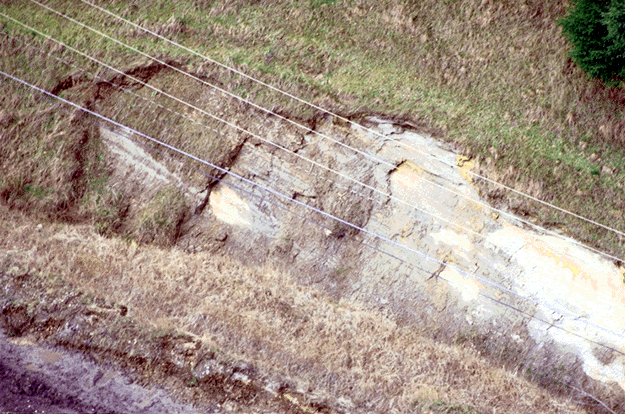
Pipeline Slide
Slide is located at a pipeline right-of-way 1.5 miles due east of Nulls Crossing. The pipeline intersects a road at this point. It is possible that this slide was not affected by the earthquake, however the presence of newly fallen trees near the slide scarp may indicate that it was seismically induced.
(N46 42 19.9 W122 49 41.5, 3/4/01)
*Artim, E. R., 1976, "Slope Stability Map of Thurston County, WA". Department of Natural Resources, Geologic Map, GM 16.
(N46 42 19.9 W122 49 41.5, 3/4/01)
*Artim, E. R., 1976, " Relative Ground Settlement Hazards of Thurston County, WA". Department of Natural Resources, Geologic Map, GM 16.
(N46 42 19.9 W122 49 41.5, 3/4/01)