
Some Observations of Geotechnical Aspects of the February 28, 2001, Nisqually Earthquake in Olympia, South Seattle, and Tacoma, Washington
Soil Liquefaction and Ground Failure
Waterfront Structures
Port of Seattle
Terminal 18, Harbor Island, Seattle
Clck on image to enlarge it.
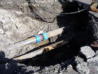
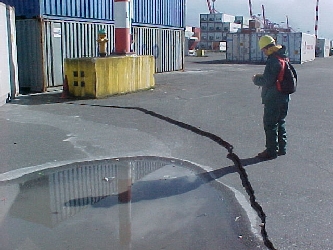
Post-earthquake water pipe break (WP 135 in plan view map). Although only one of the two pipes broke, this is still a clear indicative of liquified ground.
(N47.57380° W122.34828°; 03/02/2001)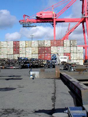
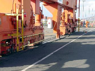
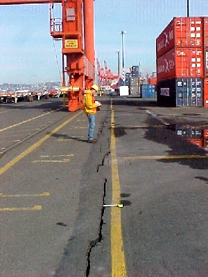
South to north view of the crack along the contact between the pile supported structure over which the cranes operate and the earth fill over which the containers are stored. At the point where this photo was taken a 5 cm vertical drop was measured (WP 136 in plan view map)
(N47.57559° W122.34664°; 03/02/2001)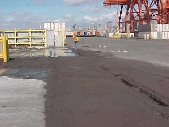
Sand boils found along a crack with a maximum measured vertical drop of 13 cm (see WP 138 on plan view map). This crack is not along the contact between the pile supported structure over which the cranes operate and the fill. The crack extends for a length of approximately 100 meters.
(N47.58877° W122.34706°; 03/02/2001)
Particle size analysis test performed on the ejected soil found at the northeast end of Terminal 18 (WP 138 on plan view map). The soil classifies as SM (Silty fine sand) according to the USCS. 29% in weight passes the #200 sieve.
(N47.58877° W122.34706°)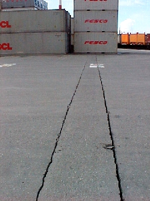
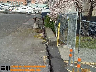
Extension Cracks found running along what was is pressumed to be a buried utility line. Each of these cracks measured 1 cm to 2.5 cm.
(N47.58931° W122.34715°; 03/02/2001)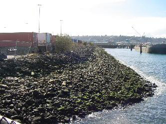
East to west view of the rockfill levee at the north end of Terminal 18.- Clck on image to enlarge it.
Circular shaped crack with a maximum vertical settlement of 6 cm. The crack's length is approximately 20 meters and is located close to the Crowley Maritime Corporation facilities.
(N47.58881° W122.34937°; 03/02/2001)

Terminal 5
Cracks in the internal side of the rails of the crane. Due to the advent of large gauge cranes, the width of the pile supported structure was no enough to accomodate the new 100 feet cranes, therefore the internal rail runs over a separate structure that consists of a pile supported beam. This configuration caused both rails to behave differently under shaking. The crane was not located at this point during the earthquake.
(N47.57960° W122.36186°; 03/02/2001)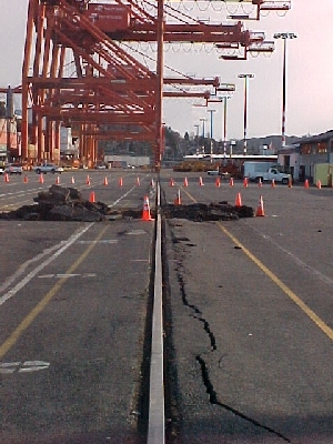
The rails of the crane separated a maximum of 2 inches between 1900 and 2300 feet. However, once the crane slowly traveled over them, this separation was corrected. The location of a test pit for inspection of the pile supported beam is seen in the photo. Divers inspected the conditions of the pile supported deck.
(N47.57960° W122.36186°; 03/02/2001)
Terminal 30
South to north view of crack along the contact between the pile supported structure over which the cranes operate and the earth fill over which the containers are stored. The opening of the crack is approximately 2 cm to 3 cm and the vertical offset is 4 cm to 5 cm.
(N47.58479° W122.34074°; 03/02/2001)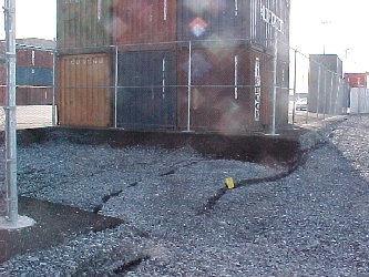
Slumping of the compacted gravel fill at the northwestern end of Terminal 30. The horizontal displacement measured in the cracks adds up to more than 30 cm. Very little to no ravelling was observed along the steep free face and no surface evidence of liquefaction was observed in the close vicinity of the slope.
(N47.58462° W122.34209°; 03/02/2001)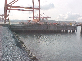
Compacted gravel overlying a rockfill levee along the north end of Terminal 30. The slope of this face is about 1:1.5. The pile supported structure is seen in the background.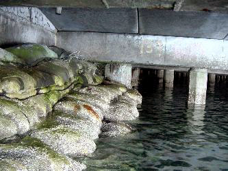
A view from underneath of the pile suported structure at the contact with the earth fill. As seen in the photo, the two structures are divided by a concrete key wall and protected by concrete sacks. Damage to piles was not evident.
Port of Olympia
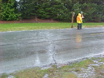
Cracking of road in the Port of Olympia due to liquefaction.
(N47.05564° W122.89985°; 03/01/2001)
Particle size analysis test performed on the ejected soil found in the vicinity of the crack shown in the photo to the left. The soil classifies as SP (Poorly graded fine sand) according to the USCS. The soil was rich in shells.
(N47.05564° W122.89985°)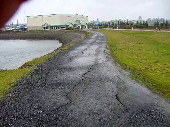
1 cm to 2 cm wide cracks parallel to 20 foot-high slope along the east end of the Swanton Marina & Boatworks.
(N47.05115° W122.89602°; 03/01/2001)
US Naval Reserve, located at south end of Lake Union, Seattle.
4" wide crack that is evidence of displacement of the Pier towards the north with respect to adjacent Naval Reserve Center.
(03/03/2001)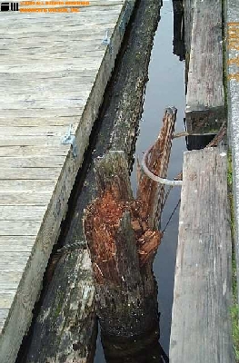
Fender pile destroyed.
(03/03/2001)