Some Observations of Geotechnical Aspects of the February 28, 2001, Nisqually Earthquake in Olympia, South Seattle, and Tacoma, Washington
Soil Liquefaction and Ground Failure
Buildings
South of Downtown, Seattle
Fill settlements of about 1 cm were typically observed in the Pioneer Square area of Seattle. Fill settlement at the Seattle Fire Dept. headquarters building is shown above.
(N47.5998° W122.3318°; 03/02/2001)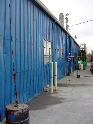
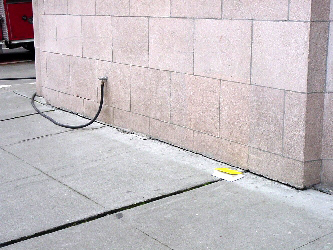
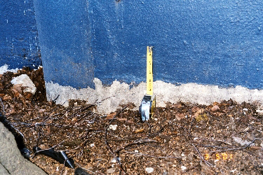
Sand ejecta along edge of foundation in south Seattle, along 4th St..
(N47.5833° W122.3294°; 03/03/2001)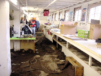
Sand slurry inundated the basement of this warehouse located on Hanford St. between 1st. Ave. and Occidental Ave. The perimeter wall appeared to have buckled inward.
(N47.5752° W122.3336°; 03/03/2001)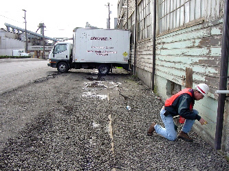
Inspection of the perimeter wall along Occidental Ave. revealed cracks on the ground surface and outward displacement of the top of the wall of 2 cm to 3 cm.
(N47.5752° W122.3336°; 03/03/2001)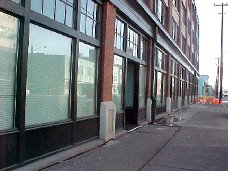
5 cm to 7 cm settlement of the sidewalk surrounding this 4-story building located on 1st. Ave. in south Seattle
(N47.5820° W122.3334°; 03/03/2001)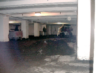
4 of the garage slabs of the 8-foot deep basement at the location shown to the left, heaved 2 to 3 feet. The garage was also inundated as a result of the breakage of the 4-inch pipe that provides water to the building. Although initially yellow tagged, this building was fully operational 2 days after the earthquake.
(N47.5820° W122.3334°; 03/03/2001)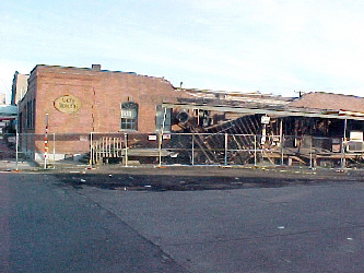
Structural damage of red-tagged masonry building in South Seattle.
(N47.5838° W122.3339°; 03/04/2001)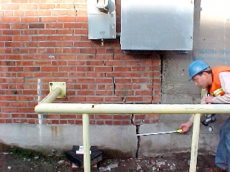
At NE corner of building shown to the left, the grade beam cracked (~4.5 cm opening with 1.5 cm of vertical offset) and damaged column and wall that it supported.
(N47.5838° W122.3339°; 03/04/2001)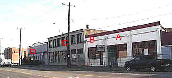
These four buildings all showed different levels of performance. Building D, on the left of the photo, shows signs of long term settlements to the north (to the left in the photo). The second building from the left, building C, had a number of sandboils in the basement area and differential settlements of a addition at the rear of the building. Buildings A and B and the building barely visible on the right experienced partial collapse at the rear of the buildings. Differential settlements between the buildings and the adjacent sidewalks varied from less than 0.5 cm at the right hand side of the photo to more than 10 cm at the doorway to building C.
(N47.57722° W122.33385°; 910 03/03/01)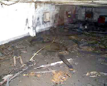
This sand boil in the basement of building C measured approximately 2 m in diameter. This sand boil was typical of six other similar sandboils in the basement.
(N47.57728° W122.33329°; 1601 03/02/01)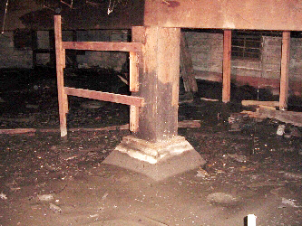
The basement of building C, located on 1st Ave. was covered by approximately 2 feet of sand that ejected from sand boils. The building is supported on piles.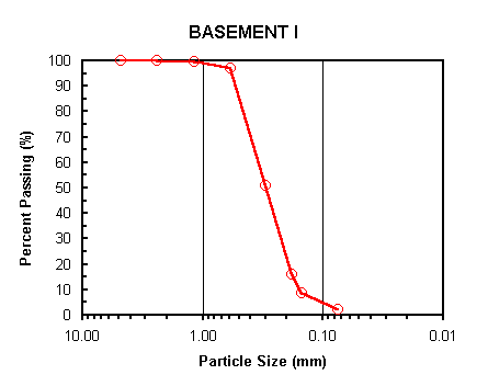
Particle size analysis test performed on the ejected soil found in the basement shown to the above. The soil classifies as SP (Poorly graded fine sand) according to the USCS.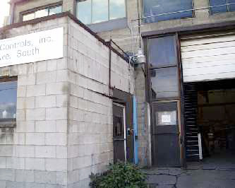
The concrete block addition at the rear of building C, which is believed to be on spread footings, has undergone significant differential settlements with respect to the original building. The distance between the jamb and the top of the door was measured to be 12.7 cm.
(N47.57728° W122.33329°; 1601 03/02/01)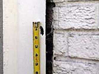
This image is of a piece of metal flashing between buildings B and C. The flashing is attached to building C and was nailed into the masonry of B. Differential settlement allowed the nail to pull through the flashing. The measured offset between the nail and the hole in the flashing was approximately 4 cm. Roofing material for building B was also attached to the C building. The roofing was also torn in tension and showed similar relative settlements.
(N47.57718 W122.33344; 913 03/03/01).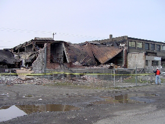
A view from the back of the collapse experienced by buildings A and B. Approximately 3 cm of differential settlement was observed across the 16 m-long basement grade beam. However, most damage appears to be due to structural response.
(N47.5769° W122.3336°; 03/02/2001)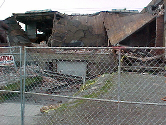
Close-up of the back of building B, located between 1st. Ave. and Occidental Ave. The sand in the lower left corner of photo appears to be sand ejecta.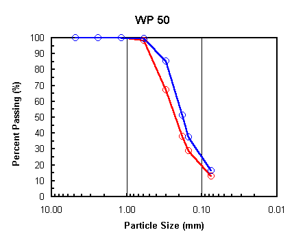
Particle size analysis tests performed on the ejected soil found in the basement ramp shown to the left. Both soil samples classify as SM (Silty fine sand) according to the USCS.
US Naval Reserve Center
10 cm settlement measured at the northwest corner of the US Naval Reserve Building No. 10
(03/05/2001)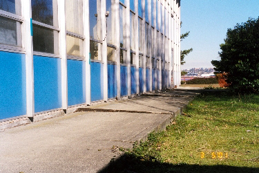
View of the settlement observed along the perimetral concrete walkway of Building No. 27.
(03/05/2001)