
Nantou - Site C
Site Map
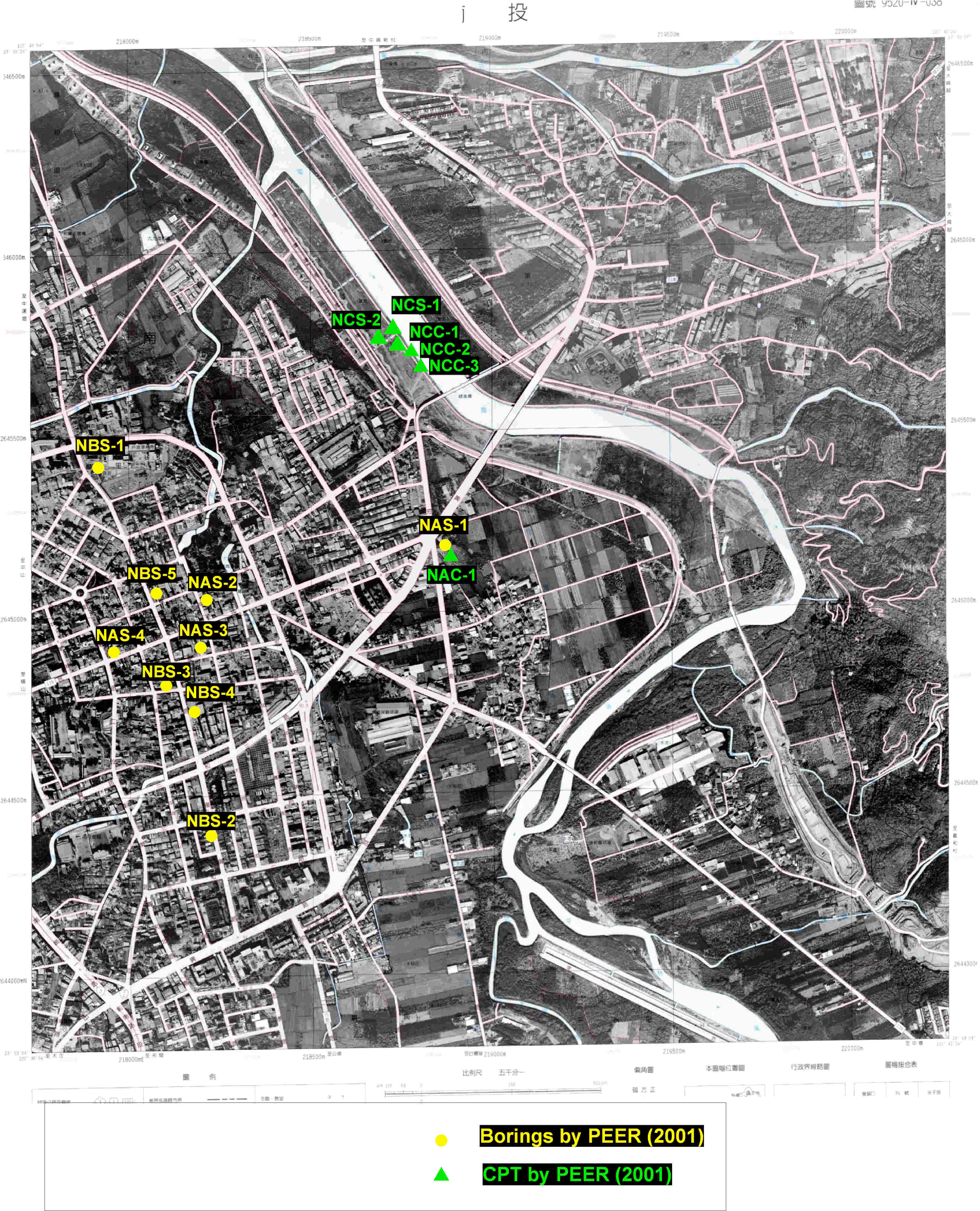
- Location: Along Miao-Lo River, Northwest of Lieu-Mei Bridge, Nantou
- GPS Coordinates:
| TEST | TYPE | DEPTH (m) |
GROUND FAILURE | SITE PHOTOS (click on photos for higher resolution images) |
|---|---|---|---|---|
| CPT-NCC-1 CPT log (PDF file - 110 KB) CPT data file (Excel file - 44 KB) |
CPT | 4.9 | Lateral Spreads |
 Photo taken in 2001 |
| CPT-NCC-2 CPT log (PDF file - 111 KB) CPT data file (Excel file - 44 KB) |
CPT | 4.4 | Lateral Spreads |
 Photo taken in 2001 |
| CPT-NCC-3 CPT log (PDF file - 110 KB) CPT data file (Excel file - 44 KB) |
CPT | 3.5 | Lateral Spreads |
|
| SPT-NCS-1 boring log (html) |
Boring with SPT | 18 | Lateral Spreads |
|
| SPT-NCS-2 boring log (html) |
Boring with SPT | 19.5 | Lateral Spreads |
Questions or comments:
jstewart@seas.ucla.edu
© Copyright 2003, Regents of the University of California
DISCLAIMER