
Some Observations of Geotechnical Aspects of the February 28, 2001, Nisqually Earthquake in Olympia, South Seattle, and Tacoma, Washington
Soil Liquefaction and Ground Failure
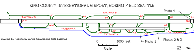
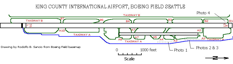
Airports
King County International Airport, Boeing Field, Seattle
Clck on image to enlarge it.
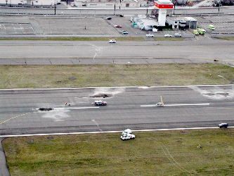
East to west aerial view of the area around the control tower showing the location of sand boils on the main runway.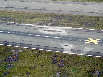
Aerial view of sand boils on main runway.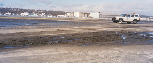
Photo 1- Approximately 85-meter long crack with sand ejecta on the taxiway in front of the terminal conference room. Horizontal deformation was 2.5 cm with 1.25 to 2.5 cm vertical offset. Sand is located on Taxiway A as shown on the map above.(10:15; 03/02/01)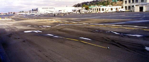
Photo 2 - Crack of the taxiway pavement approximately 35-meter long between two storm drains. The pavement settleled 5 cm and separated 3.8 cm relative to the main catch basin. Sand ejecta was deposited around the cracks. (10:20; 03/02/2001)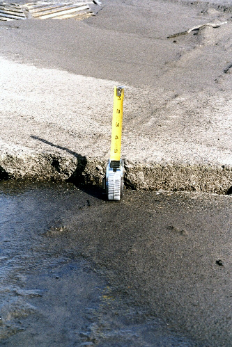
Photo 3 - Close-up of the crack described in the photo above.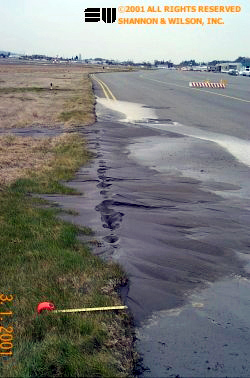
A line of sand boils along Taxiway A. (03/01/2001)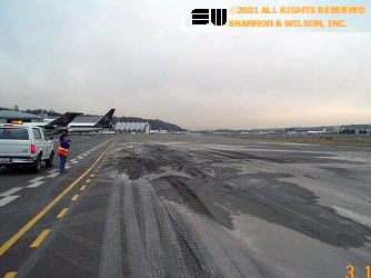
xxx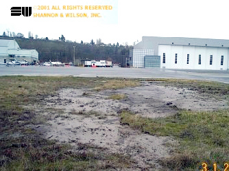
Liquefaction in grassy area north of taxiway A-6 resulted in 8 to 9 inches of settlement. (12:00; 03/01/2001)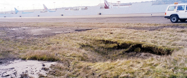
Photo 4 - 4.5-m by 3.5-m sinkhole with a maximum depth of 1.2 meter. Two sand boils were observed to the east and south of the sinkhole. The farthest boundary of the southern sand boil was 11 meters away from the sinkhole boundary. (10:45; 03/02/2001)